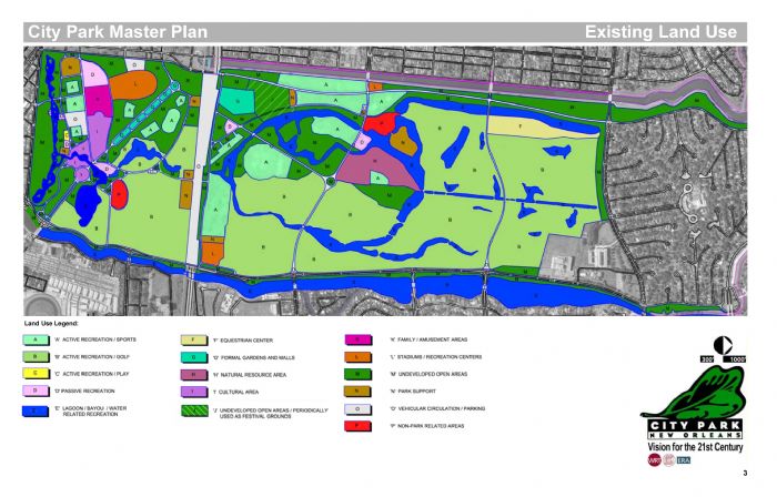
In these land use maps from the 2005 City Park Master Plan and the revised version from 2007, the deep green areas labeled "M" represent "undeveloped open areas", which includes the grassy strips along roads as well as limited public access areas such as Scout Island; the purple areas labeled "H" represent "natural resource areas" such as Couturie Forest; and the light lime green areas labeled "B" are for golf. It is evident in this map that golf consumed more than 50% of the land in the park previous to 2005, when the south course was closed to make way for a fenced "festival" area whose public access has not been made clear. Despite the distinction between the purple and green areas of Couturie Forest, there is no physical or visual difference between these areas.
)